Themes & Projects
Browse
All Items
Divisions
Subjects
My Collections
Themes & Projects
About
Advanced Search
Help us improve our site.
Please take our survey
!
Digital Collections User Survey
×
Loading…
Home
Filtered search
FILTER SEARCH
Exclude Born Digital Content
DATE RANGE
to
Limit
ONLINE FORMAT
Image
38
Folder
1
Text
1
ORIGINAL FORMAT
maps
ORIGINAL FORMAT
×
ORIGINAL FORMAT
COUNT
maps
39
LOCATION
Fear, Cape (N.C.)
2
Bath (N.C.)
1
Beaufort County (N.C.)
1
Bertie County (N.C.)
1
Brunswick County (N.C.)
1
Carteret County (N.C.)
1
Chowan County (N.C.)
1
More
LOCATION
×
LOCATION
COUNT
Fear, Cape (N.C.)
2
Bath (N.C.)
1
Beaufort County (N.C.)
1
Bertie County (N.C.)
1
Brunswick County (N.C.)
1
Carteret County (N.C.)
1
Chowan County (N.C.)
1
Craven County (N.C.)
1
Cumberland County (N.C.)
1
Halifax County (N.C.)
1
Harnett County (N.C.)
1
Hertford County (N.C.)
1
Hoke County (N.C.)
1
Johnston County (N.C.)
1
Jones County (N.C.)
1
Kitty Hawk (N.C.)
1
Lenoir County (N.C.)
1
North Carolina
1
Onslow County (N.C.)
1
Pamlico County (N.C.)
1
Pasquotank County (N.C.)
1
Pender County (N.C.)
1
Perquimans County (N.C.)
1
Robeson County (N.C.)
1
Scotland County (N.C.)
1
Tyrrell County (N.C.)
1
Wayne County (N.C.)
1
THEME/PROJECT
Agriculture
23
North Carolina History and Fiction Collection
23
North Carolina Maps
11
Military History
5
Military History: Marines
3
Military History: Navy
2
Military History: World War II
2
More
THEME/PROJECT
×
THEME/PROJECT
COUNT
Agriculture
23
North Carolina History and Fiction Collection
23
North Carolina Maps
11
Military History
5
Military History: Marines
3
Military History: Navy
2
Military History: World War II
2
Bath Tricentennial
1
Social and Family Life
1
SUBJECT
Cape Fear River (N.C.)--Maps
2
Cape Fear River (N.C.)--Navigation
2
Fear, Cape (N.C.)--Maps
2
Nautical charts--North Carolina--Cape Fear River
2
Bath (N.C.)--History
1
Bath (N.C.)--Surveys
1
Bath Creek (Bath, N.C.)
1
More
SUBJECT
×
SUBJECT
COUNT
Cape Fear River (N.C.)--Maps
2
Cape Fear River (N.C.)--Navigation
2
Fear, Cape (N.C.)--Maps
2
Nautical charts--North Carolina--Cape Fear River
2
Bath (N.C.)--History
1
Bath (N.C.)--Surveys
1
Bath Creek (Bath, N.C.)
1
Coasts--North Carolina
1
Dare County (N.C.)--Maps
1
Fryingpan Shoals (N.C.)--Maps
1
Fryingpan Shoals (N.C.)--Navigation
1
Kitty Hawk (N.C.)--Maps
1
Nautical charts--North Carolina--Fryingpan Shoals
1
North Carolina--Maps
1
Soils--North Carolina--Beaufort County--Maps
1
Soils--North Carolina--Bertie County--Maps
1
Soils--North Carolina--Brunswick County--Maps
1
Soils--North Carolina--Carteret County--Maps
1
Soils--North Carolina--Chowan County--Maps
1
Soils--North Carolina--Columbus County--Maps
1
Soils--North Carolina--Craven County--Maps
1
Soils--North Carolina--Cumberland County--Maps
1
Soils--North Carolina--Halifax County--Maps
1
Soils--North Carolina--Harnett County--Maps
1
Soils--North Carolina--Hertford County--Maps
1
Soils--North Carolina--Hoke County--Maps
1
Soils--North Carolina--Johnston County--Maps
1
Soils--North Carolina--Jones County--Maps
1
Soils--North Carolina--Lenoir County--Maps
1
Soils--North Carolina--Onslow County--Maps
1
Soils--North Carolina--Pamlico County--Maps
1
Soils--North Carolina--Pasquotank County--Maps
1
Soils--North Carolina--Pender County--Maps
1
Soils--North Carolina--Perquimans County--Maps
1
Soils--North Carolina--Robeson County--Maps
1
Soils--North Carolina--Scotland County--Maps
1
Soils--North Carolina--Tyrrell County--Maps
1
Soils--North Carolina--Wayne County--Maps
1
U.S. Coast and Geodetic Survey
1
DIVISION
Joyner NC Rare
20
East Carolina Manuscript Collection
9
Joyner NC Maps
3
Joyner NC Stacks
2
Joyner NC Maps Oversize
1
Joyner Rare
1
DIVISION
×
DIVISION
COUNT
Joyner NC Rare
20
East Carolina Manuscript Collection
9
Joyner NC Maps
3
Joyner NC Stacks
2
Joyner NC Maps Oversize
1
Joyner Rare
1
Filters
Search Results
39 results found for:
Methodist Protestant Church (U.S. "1830-1939)"
Original Format:
maps
Sort by:
Relevance
Date Digitized
Date Created
Eastern Craven County North Carolina Highway Map (...
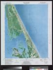
Kitty Hawk Quadrangle, North Carolina, Dare Co., 7...
Map of North Carolina coast
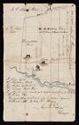
Surveyor's Map of W. H. Fortescue's Land in Hyde C...
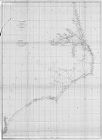
Sketch of Frying-Pan Shoals
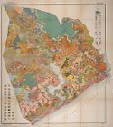
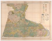
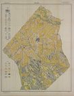
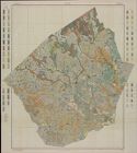
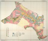
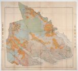
Soil map, North Carolina, Chowan County sheet
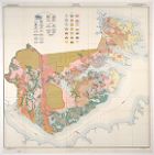
Soil map, North Carolina, Tyrrell County sheet
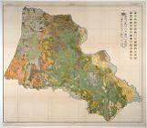
Soil map, Lenoir County, North Carolina
Map of Wilmington Presbytery
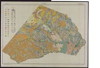
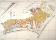
Soil map, North Carolina, Beaufort County sheet
Soil map, North Carolina, Bertie County sheet
Soil map, Brunswick County, North Carolina
Soil map, North Carolina, Columbus County sheet
Soil map, Craven County, North Carolina
Soil map, North Carolina, Cumberland County sheet
Soil map, North Carolina, Wayne County sheet
Soil map, North Carolina, Pender County sheet
Soil map, North Carolina, Robeson County sheet
Soil map, North Carolina, Onslow County sheet
Soil map, Pamlico County, North Carolina
Soil map, North Carolina, Halifax County sheet
Soil map, North Carolina, Harnett County sheet
Soil map, North Carolina, Hertford County sheet
Soil map, North Carolina, Hoke County sheet
Soil map, North Carolina, Johnston County sheet
Soil map, Jones County, North Carolina
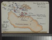
Night action off Savo Island, August 8, 1942
Soil map, North Carolina, Pasquotank and Perquiman...
Eastern Craven County and Carteret County, North C...
The approach and air searches, dog day, operation ...
Maps of Saint Paul's Episcopal Churchyard. Edenton...
Eastern Craven County North Carolina Highway Map (...
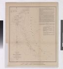
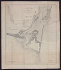
Entrances to Cape Fear River
Soil map, North Carolina, Scotland County sheet
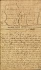
Survey of Bath Town Creek
Soil map, Carteret County, North Carolina
A Plan of the Town & Port of Edenton in Chowan Co...
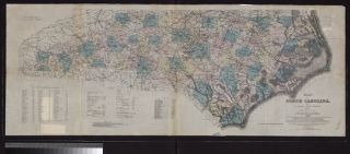
Map of North Carolina by W.C. Kerr ; assisted by W...
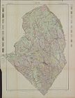
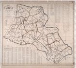
Map of the county of Halifax, North Carolina, 1914...